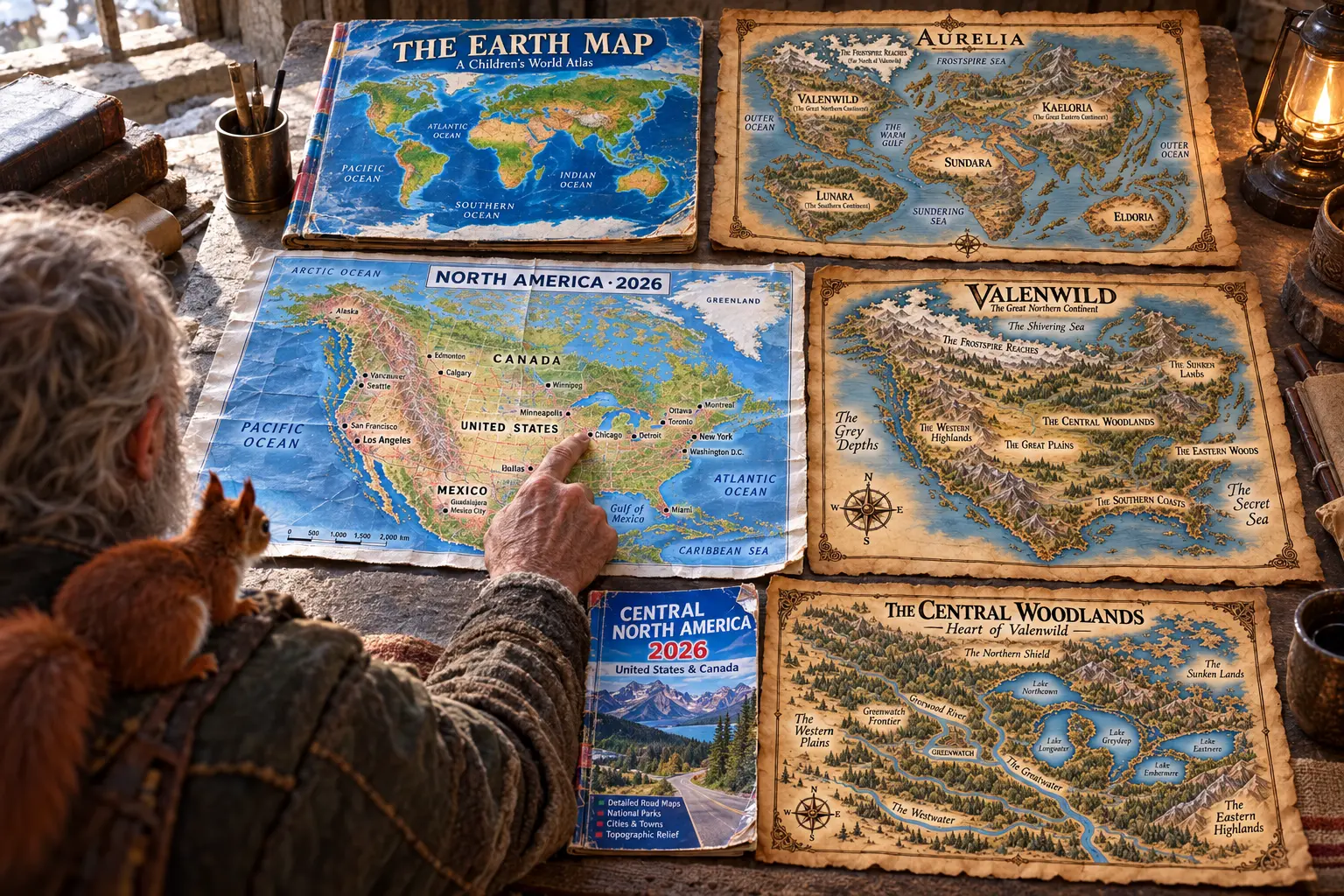
Spread across a tavern table, an old atlas of Earth lies open beside the charts of Aurelia: a well-worn world atlas, a road map of North America and a traveller's guide to its central reaches, set against the maps of Valenwild and the wider world. Comparing them is a habit every cartographer falls into eventually — looking for the familiar inside the unknown.
A familiar shape
The resemblance is difficult to unsee. Valenwild's western coast falls away into the Grey Depths where the Pacific would lie, while the Secret Sea opens to the east as the Atlantic does. The Shivering Sea presses against the Frostspire Reaches in the north, and the Warm Gulf sits low on the southern coast — a gulf in much the same place as the one its name suggests.
The parallels run deeper than coastlines. The Great Plains spread across Valenwild's heart, the Western Highlands climb where the Rockies climb, and the Eastern Woods fall toward the Secret Sea as the old forests of the east once fell toward theirs.
The heart of the continent
The comparison is at its most striking in the Central Woodlands. The Greatwater winds through the region the way a great river winds through central North America, gathering waters from lakes that sit where the Great Lakes sit. Greenwatch guards its frontier, and the Sunken Lands lie to the north-east as the older, colder country does.
Whether this is coincidence, echo or something stranger is a question the maps refuse to answer. Aurelia's scholars have their theories; the clans have their own stories; neither agrees with the other.
A tool for the table
For Games Masters, the comparison is useful even if it is never spoken aloud. Placing Aurelia's geography beside a familiar world gives expeditions an instinctive sense of scale — how long the crossing from the Western Highlands to the Southern Coasts might take, and what kinds of country lie between.
The atlas returns to its shelf and the maps stay on the table. Whatever the truth of the resemblance, the journeys run through Aurelia — and those are the journeys that matter.